Banaba Island (Banaba)
Banaba (also Ocean Island) is an island of Kiribati in the Pacific Ocean. A solitary raised coral island west of the Gilbert Island Chain, it is the westernmost point of Kiribati, lying 185 mi east of Nauru, which is also its nearest neighbour. It has an area of 6 km2, and the highest point on the island is also the highest point in Kiribati, at 81 m in height. Along with Nauru and Makatea (French Polynesia), it is one of the important elevated phosphate-rich islands of the Pacific.
According to Te Rii ni Banaba—The Backbone of Banaba by Raobeia Ken Sigrah, Banaban oral history supports the claim that the people of the Te Aka clan, which originated in Melanesia, were the original inhabitants of Banaba (Ocean Island), having arrived before the arrival of later migrations from the East Indies and Kiribati. The name Banaba in the local Gilbertese language is correctly spelled Bwanaba, but the Constitution of Kiribati (12 July 1979) writes Banaba, meaning "hollow land".
Sigrah makes also the controversial (and politically loaded) assertion that Banabans are ethnically distinct from other I-Kiribati. The Banabans were assimilated only through forced migrations and the heavy impact of the discovery of phosphate in 1900. Prior to the relocation of its inhabitants at the end of World War II, there were four villages on the island: Ooma (Uma), Tabiang, Tapiwa (Tabwewa) and Buakonikai. The local capital was Tabiang, now called Antereen.
The first known sighting of Banaba by Europeans occurred on 3 January 1801. Captain Jared Gardner of the American vessel Diana sighted the island. Then in 1804, Captain John Mertho of the convict transport and merchant ship Ocean sighted the island and named it after his vessel.
Whaling vessels often visited the island in the nineteenth century for water and wood. The first recorded visit was by the Arabella in March 1832. The last known visit was by the Charles W. Morgan in January 1904.
Banaba is prone to drought, as it is a high island with no natural streams and no water lens. The traditional source of water was a cave in which fresh water collected. A three-year drought starting in 1873 killed more than three-quarters of the population and wiped out almost all of the trees; many of those who survived left the island on passing ships to escape the drought, and only some were able to return, often years later.
Map - Banaba Island (Banaba)
Map
Country - Kiribati
 |
 |
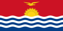
| Flag of Kiribati | |
The islands' spread straddles the equator and the 180th meridian, although the International Date Line goes around Kiribati and swings far to the east, almost reaching 150°W. This brings Kiribati's easternmost islands, the southern Line Islands south of Hawaii, into the same day as the Gilbert Islands and places them in the most advanced time zone on Earth: UTC+14.
Currency / Language
| ISO | Currency | Symbol | Significant figures |
|---|---|---|---|
| AUD | Australian dollar | $ | 2 |
| ISO | Language |
|---|---|
| EN | English language |


